Public Trees at 42.33 N 71.12 W
Submitted Sat Jun 24, 2017
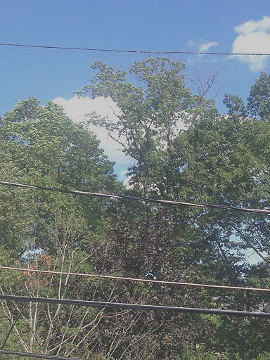
Hi -- The tree in this photo from my house is across the street from 80-something Davis Avenue, on the edge of Emerson Garden. I'm not sure whether the photo conveys this, but the tree is very tall -- one of the tallest in the area -- and the dead upper branches have been deteriorating rapidly and appear to be in very bad shape. If they came down on someone or something on Davis Avenue, it could be catastrophic, given their height. It was a lovely tree, but has been dying back fast over the last two years.
address: 42.33 N 71.12 W
coordinates x,y: 758046.9114510865, 2946285.7854575682
coordinates lat,lng: 42.33214118056216, -71.12321234314807
| Timestamp | Description |
|---|---|
| Fri Jul 28, 2017 12:32pm | |
| Sat Jun 24, 2017 07:47pm | |
| Sat Jun 24, 2017 07:47pm |
Request submitted via iPhone |